Ipinapakita ang mga post na may etiketa na Climb logs. Ipakita ang lahat ng mga post

Linggo, Pebrero 7, 2016

Gorgeous walk at Mt. Ulap and Hydro Falls


MT. ULAP ECO-TRAIL
Itogon, Benguet

Entry point: Brgy. Ampucao, Itogon
Exit point: Brgy. Sta. Fe, Itogon
LLA: 16.2904 N, 120.6312 E, 1846 MASL (Mt. Ulap)
Days required / Hours to summit: 1 day / 2-3 hours
Specs: Difficulty 3/9, Trail class 1-3,
Features: Grassland and pine ridges, scenic views of the Cordilleras, burial caves


I love the pictures I have seen from people standing on the edge of a protruding rock that looked like it will break at any moment. Upon my research, I found out that the rock formation is part of the features of Mt Ulap eco-trail. I figured I had to go check it out for myself.  I had wanted to do this hike for awhile, but just never had the opportunity until recently.

7 AM

We started the hike a little later than we anticipated , got there just before 6 am. After the registration and a quick orientation the group started right away. 

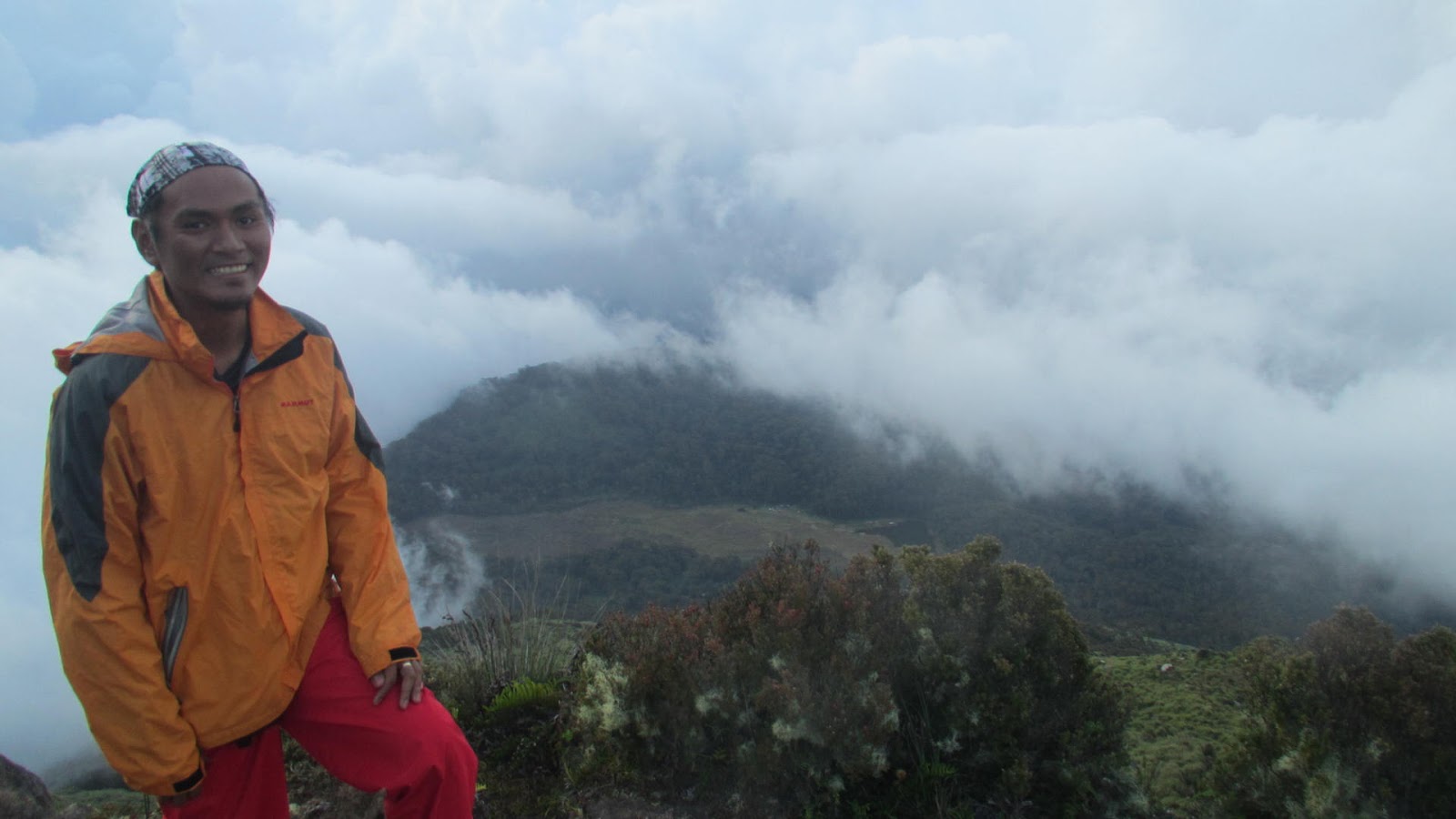
The morning air was a little cooler when we started, but as the hike continued, we were definitely sweating.  It is straight uphill from the beginning - On the hike up, you could see beautiful views of the surrounding mountains, and the scenery is gorgeous right from the start to finish.

The beginning is a bit challenging- it's a little steep- but once you get to the start of the trail going to the first peak , it is easy with a little danger but with a shaded trail. 

This is a fun hike. It is moderately easy climb but with a longer trail than I expected.   Our group went at a moderate pace with some breaks. 

When we finally reached the Gungal Rock, there was a long line of people wanting to take pictures on the rock. It was a Sunday noon, so I'm sure there would be less people on a weekday. I can see why people would want to give this place a bad review due to the long line but in terms of the actual hike, it was very enjoyable and had great views almost the entire way up and down , so I would say it was worth the hike.

As we were making our way down the mountain, the trail was noticeably more crowded. Plus, it was steeper.  Coming down may have been slightly faster than hiking up the mountain, but it's also scarier because the path gets slippery, just be extra careful from the rocks and some roots jutting out. 

Here are some tips for some of you who plans to hike Ulap. 


Go early. Our group planned to start early on a Sunday. We didn't end up starting until around 7 a.m. So before it gets hot and before the trail gets more crowded start the hike early. Or i suggest Go on a weekday to avoid long lines of people.

Bring enough water and pack light. The sta fe traverse is longer than expected. From the first peak going to Gungal rock it is mostly expose to the sun. 

Take alot of pictures - we had fun with this experience and took photos. 


Sabado, Enero 30, 2016

Reuniting with Mt. Tarak


The last time I did Tarak is back in 2011, back then it is in my head as one of my favorite hike. And, on my 3rd visit to Mt. Tarak, I reunited with my hiker cousins, Rodnie and Reynald.

We began the hike around 3:00 pm - and the sun is still out. The weather is pretty good, and the trail itself is well shaded.  It starts out slow and kind of flat before you get to the actual base of the mountain which starts from Nanay Cording's house, and from there it gets steeper.

The advantage of hiking late in the afternoon was the temperature. It was still relatively warm at 4:30-5, but not unbearably hot. In total, it took us 4 hours to hike up to the summit. 

The trail is not a peaceful getaway like I was hoping for, but it has some beautiful views.  There were a lot of people at the ridge and it almost felt like there's a party. I enjoy hiking to get away from  the buzz of the metro, so I would recommend some less traveled hikes if serenity is what you are looking for.


Sabado, Setyembre 26, 2015

Finding Mt. Kofafey and Mt. Fato


I'm so glad to finally check Mt Kofafey off my Bucket list. I've made several attempts to climb Mt Kofafey but it just didnt happen. I however decided it was time to climb kofafey, that very few people visit while in Bontoc. And, Finally i made it back to Maligcong just six months after my last attempt and at the right time I completed Mt Kofafey traverse.

I took a long walk on the rice terraces and enjoyed the views. It really is spectacular. The hike is really beautiful and gives stunning views of the maligcong rice terraces. I hiked in the pouring rain, but my breathing and energy level was still good, and it was a fantastic experience. The setting alone is magnificent. The shape of the mountains are so unique and the landscape from every view point looked different and it changed throughout the day from the mist and clouds that would quickly move in and out. The intricately constructed rice terraces are on a mountain surrounded by other soaring peaks. It reminded me of the views at Batad, Hapao, Mayoyao and Banaue. Absolutely breathtaking!

I cannot believe I made it and I went to Mt kofafey without a GUIDE, I'm still amazed.

I had some time exploring, it was almost sunset - it was freezing cold, but i enjoy it and I admired the view. Though, there actually wasn't much of a sunset because it was overcast, I think the fog drifting throughout the mountains and terraces was even better.

After a few hours at the summit it was time to go - it started to rain hard - I kinda didn't want to leave, thinking this could be the only time I will ever see this, but i have to leave for now KOFAFEY - the descent down to the village was really steep with lots of steps. I thought the decline was harder than going up , so it took alot of my time and energy. I tried not to look down descending from the summit and that seemed to help.  The pictures don't do justice to how steep the trail going down.  In the end I'm glad I hiked Mt Kofafey.  The views from the top were amazing and I could see all of the mountain ranges in the distance.

I love nature and hiking, and I also love learning about other cultures. Maligcong really satisfied all these loves.

I rewarded myself for the long walk with a sumptuous dinner from Ate Suzette's and 3 cups of mountain tea to soothe my aching legs.  I laughed thinking after all these years of wanting to climb mt kofafey, FINALLY i successfully finish it!

P.s  My special thanks to KUNIG - the dog wonder - for being a wonderful GUIDE!!!


How to get to Maligcong,Bontoc?
Coming from Manila take a bus bound for Banaue or directly to Bontoc. In my case I took the Ohayami Bus Terminal in Fajardo St. Sampaloc, Manila. Fare of Php 450.00 is bound for Banaue. Coda Bus line offers direct trip to Bontoc for Php 750.

From Banaue, take a van/jeepney bound for Bontoc. Fare is Php 150 to 200.

Then from Bontoc there are regular jeepney transfers from Bontoc town proper to Maligcong and vice versa, schedules is from morning up to the late afternoon. The terminal is along the Capitol Road just behind the market. Jeepney fare is Php 25 and travel time is 25-30 minutes.

Accomodation
Suzette’s Maligcong Homestay
Rate: Php 300 per night per person
Owner: Suzette Chess  Contact Number: 09155463557

Footnotes
Planting season starts in March, so the best time to visit and see the green rice paddies is April and May. Harvest season is August and may -it may extend to September - and the Maligcong rice terraces at this time is in shades of gold and green.

Aside from trekking Mount Kofafey and Mt Fato, you can also explore the terraces and the surrounding villages either alone or by hiring a guide. 


Lunes, Hulyo 27, 2015

Mt Kaybigas traverse Mt Tilos


The journey began very early in the morning.

Our destination is the town of Lobo. It may not top mountaineers lists for dayhikes, 
after all there are many more known mountains in Batangas. However, do not dismiss it 
just yet, after yesterdays visit to Lobo i found  a great deal to recommend such a 
great mountain for dayhike. 

Lobo is about 145 kilometres from Manila,(according to google)and is located near the 
southern tip of Batangas province. It has good white sand beaches and has very good 
coral and marine life on some of its beaches that attract many snorkelers, scuba 
divers and underwater photographers. It also has fish sanctuaries and the famous 
Malabrigo Light house. Lobo is truly a charming little coastal town.

5 AM. I love long rides. We left early dawn so there is no views yet. I managed to get 
some sleep on the road, but when i notice that the sun is preparing to set I then 
couldn’t sleep again. Beyond that, I also had a keen eye for what the casual traveler 
might not spot.

The long narrow roads to Lobo is quiet and scenic. The meandering mountain passes ( 
was a zigzagging path over a beautiful mountain range) with a land of striking 
landscapes that range from the lush forested mountains and the picturesque valleys 
going to the town proper -i love how the roads had been carved out of the mountainsides - passing thru the coastal town with the views of the nearby 
verde island ( consider as the "Center of the Center of Marine Shorefish 
Biodiversity"), the old Spanish Light house and the fish sanctuary. Most of the time i was feeling excited – if all goes according to plan – Did not know what to expect -  we’ll have a real good time.  

So at past 5am, we walked off the van, and into the early morning glow of Lobo i  
sense that its going to be an epic adventure. Looking at the mountains really took my 
breath away, an exciting glimpse of whats gonna happen later.
The sun is out, the skies were slightly cloudy, so its for sure we are going to be 
directly blasted by the sun.

Our first stop is Lobo Police Station for some registration. Next stop is Barangay 
Malabrigo which serve as our jump off. After our much needed breakfast, the group then 
immediately prepare for the start of the climb. 
It all started well enough. According to Sir G it would take 5-6 hours to complete Mt 
Tilos. So this is what i have in mind, 5-6 hours of hiking ? not bad, i said to 
myself. 

At first, It was an easy climb. Passing thru some houses with banana and tamarind trees, gentle slopes trees covering the trail. The first hour of the hike were mainly a mild steep ascent, around 60-70 degree-angle of inclination. But Of course, climbing isn’t always easy, there are some obstacles along the way. After 2 hours of slow-moving climb things began to change. The trail becomes different. The trail become a bit steeper with loose rocks, so I started to worry about the possibility of slipping and it makes it hard for me to balance and maintain my pace. 

After more than 2 hours we reach the grassy slopes, then the summit of Mt Kaybigas. This time the views at this point is incomparable. From here the impressive views of batangas coastline is clear. And with a clear sky, isla verde, some islets and Mindoro on the far side is visible. Enjoying the scenic view at this part, not minding the scorching heat of the sun - taking pictures of the amazing views - i envisioned myself already swimming at the beach.


Biyernes, Hunyo 12, 2015

Mt Apo : Fulfilling my dream


As a nature lover who loves to climb mountains, I often browse the net to look for beautiful pictures from different mountains in the Philippines. But there are no other images that I love the most than Mt. Apo, my country's highest.

My obsession with Mt. Apo started after completing my 3rd summit in 2002, and my curiosity grows bigger when my cousin showed me his pictures conquering Mt. Apo. Add that curiosity to the stunning beauty of the trail they called "boulders" I decided to make it to the summit of Apo one day.

The list of mountains I want to climb and experience can truly go on endlessly, but Mt. Apo have really caught my interest. I have no doubt that it will be even more captivating in person.

I could stop dreaming, and just forget Apo, i know it's a fantasy.

But, I promise myself, someday, with massive amount of faith and inspiration. I'll get there.


LinkWithin

Related Posts Plugin for WordPress, Blogger...